The site is an informational and educational resource for all Upper Nemahbin Lake Management District members as well as the general public. Please take a moment to look around. Not only will you find useful information, you have a tool that will help you get to know your neighbors in the members gallery and the Nemahbin Lake Talk forum.
Initially Upper Nemahbin.com has a good deal of fun information and some serious, issue orientated content. Check out the news articles for pertinent information, meet Lake District members in the member's gallery, and see what has happened and is happening in the Upper Nemahbin Lake Management District photo galleries. Please contribute to Upper Nemahbin Lake member's gallery images and biographies. Contribute and participate to improve our lives in the Upper Nemahbin Lake Management District as you can or are willing.

Check out our sponsorship program to access the eyes and brains of local residents with disposable income and deep loyalties to businesses within the Town of Summit and Lake Country area.
Become A SponsorEvery penny of your sponsorship will go, unfettered, to the management and enhancement of the Upper Nemahbin watershed. In return, you will receive increased patronage far beyond the investment of sponsorship.
Donate To The Fireworks FundNothing is more patriotic than donating to a reduction in taxes allocated for the fireworks AND an increased spectacle in celebration of the Declaration Of Independence and the birth of the United States of America.

Slow No Wake Alert
 Slow no wake times are between 12pm and 3pm all Sundays and legal holidays
Invasive Species Alert
Our largest undertaking to date, dredging the middle Bark River through much of Upper Nemahbin’s South East Bay has reached the point where we are able to move forward. The district will have to move fiber optic and high tension power lines. Our access abutting Panga’s parking lot will need a fully improved launch. The budget isn’t shy BUT will be fully and transparently explained at our 2020 annual meeting September 23rd, 7:00pm. Based on the cost annually for individual district tax payers, board members agree it is worth doing right.
Please attend, be heard and understand all the district is doing and intending to do from your board and volunteers who really are making a difference. Please also encourage your neighboring district members and friends to participate.
Water Quality Committee (WQC)
(Dave Cone Chairman, Mike Donaubauer, Mark Beres, Kent Brooks and Jennifer Reek)
With the removal of the Roller Mill Dam in 2013, the WQC has been meeting with WDNR staff to review and be advised on the permit process to Clean Up the Bark River directly above upper Bark River and mouth of Nemahbin Lake. To start the process to apply for permits, preliminary data was required on the amount of sediment present and the volume of sediment to be removed. During the late 2014 winter, depths and volume was calculated from a survey that was taken through the ice. A report was delivered on the details and sent to the WDNR for review. In response, we were asked to perform further analysis of the sediment which occurred in late spring of 2014. Nine samples were taken on the sediment and submitted to provide the data to fulfill a Solid Waste Permit requirements. From these results, WQC met with several WDNR staff members to discuss if the project is viable and how to proceed in the application of all permits required. WDNR staff stated that the Clean Up of the sediment is a viable project and to proceed with identifying a disposal site and funding in 2015. Contact Dave or Jennifer for more information.
Please contact myself or any of the UNLMD Board Commissioners if you have any concerns or questions. Jennifer Reek - jjrwood@aol.com - Joan Beres - mberes@wi.rr.com - Erica Ihn - Feel free to send this email on to others on the lake for their information. Thank you in advanced for your cooperation. - Jenny Jennifer Reek, UNLMD Chairman
Mentkowski Memorial Firework - July 10th, 2020, rain date July 11, 2020
UNLMD Picnic - No 2020 date set
UNLMD Annual Meeting - Wednesday, September 23rd - Location is at Summit Village Hall at 7:00 pm - Jennifer Reek up for reelection. Nomination can come from the floor at the Annual Meeting.
Hello everyone, The Board has been working hard on these major projects within the last few years.
Water Quality Committee (WQC) – (Dave Cone Chairman, Mike Donaubauer, Mark Beres, Kent Brooks and Jennifer Reek) With the removal of the Roller Mill Dam in 2013, the WQC has been meeting with WDNR staff to review and be advised on the permit process to Clean Up the Bark River directly above upper Bark River and mouth of Nemahbin Lake. To start the process to apply for permits, preliminary data was required on the amount of sediment present and the volume of sediment to be removed. During the late 2014 winter, depths and volume was calculated from a survey that was taken through the ice. A report was delivered on the details and sent to the WDNR for review. In response, we were asked to perform further analysis of the sediment which occurred in late spring of 2014. Nine samples were taken on the sediment and submitted to provide the data to fulfill a Solid Waste Permit requirements. From these results, WQC met with several WDNR staff members to discuss if the project is viable and how to proceed in the application of all permits required. WDNR staff stated that the Clean Up of the sediment is a viable project and to proceed with identifying a disposal site and funding in 2015. Contact Dave or Jennifer for more information.
CTH P bridge and weir reconstruction was presented at the Village open meeting. The weir will be constructed at the same elevation but will be extended longer to 41 feet to accommodate errors in flood plain modeling that impacts the Nemahbin Lakes. This project is to be completed in 2016.
New FEMA floodplain maps were published November 5, 2014 that affects the Nemahbin Lakes. See the link to FEMA website above. FYI, future FEMA maps will be issued after the CTH P reconstruction is completed that may reflect on further changes to the flood elevations by 2018.
USGS gage remains to be funded which is a positive for the lakes downstream of the Nagawicka dam. It is used during flooding events to monitor flood water and to record daily height/volume levels for future flood mapping. See the link on the left panel.
Communications Committee (Rudy Ibric, Steve Libbey and Jennifer Reek) The UNLMD website has been upgraded with a newer, user friendly back end. Updates to the site are now easier while having the look will remain the same. Please send any of your family pictures on the lake with a story to Jennifer or Rudy and we will refresh the content.
Please contact myself or any of the UNLMD Board Commissioners if you have any concerns or questions.
Jennifer Reek - jjrwood@aol.com
Joan Beres - mberes@wi.rr.com
Feel free to send this email on to others on the lake for their information.
Thank you in advanced for your cooperation.
Jenny
Jennifer Reek
UNLMD Chairman
 Welcome to the Upper Nemahbin Lake Management District website. The site is an informational and educational resource for all Upper Nemahbin Lake Management District members as well as the general public. Please take a moment to look around. Not only will you find useful information, you have a tool that will help you get to know your neighbors in the members gallery and the Nemahbin Lake Talk forum. Check the date and time of Upper Nemahbin Lake Management District events, meet your Upper Nemahbin Lake Management District board, make the fireworks bigger, even see the weekly weather forecast updated daily at the bottom of this home page. Come back often as articles will be added, images will be added and issues will unfold in the Forum. This website will never stop growing. Please contribute stories, articles, photos, content and ideas for future features.

Initially Upper Nemahbin.com has a good deal of fun information and some serious, issue orientated content Check out the news articles for pertinent information, meet Lake District members in the member's gallery, see what has happened and is happening in the Upper Nemahbin Lake Management District photo galleries. Please contribute to Upper Nemahbin Lake member's gallery images and biographies. Contribute and participate to improve our lives in the Upper Nemahbin Lake Management District as you can or are willing.

Mike D. gets ready to make some hard cuts and big spray on Upper Nemahbin

(https://msc.fema.gov/portal/advanceSearch)
Enter Wisconsin, Waukesha County, and the Village of Summit at the jurisdiction Search.
To View Map Panels:Under Effective Products (22) is panel 55133C0166H4 Effective Date: 11/5/2014 - Bark River, Portion of Upper Nemahbin and Lower Nemahbin Lake
Under Historic Products (35) is panel 55133C0158G Effective Date: 02/19/2014 - Upper portion of Upper Nemahbin Lake and Lower Nashotah Lake
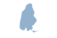
Located in the Town of Summit, Wisconsin
Lake Size: 283 Acres
1 Public Boat Access located on west shore of lake off Co. Rd. P
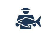
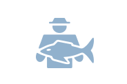
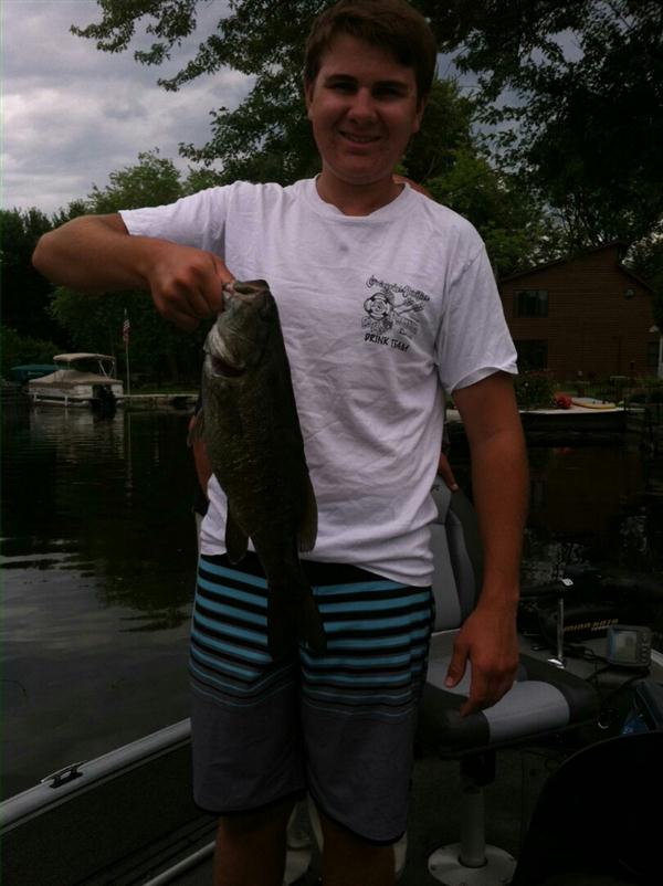
Bluegill, large and smallmouth Bass, Walleye, Northern Pike, and Crappie also caught
Maximum depth of 62 ft.
Connects to Lower Neshotah and Lower Nemahbin Lake